
Le Fond des cartes historiques sur l'Australie et le Pacifique
de la
Collection de cartes de la Perry-Castañeda Library
de The University of Texas à Austin
nous propose quelques documents remarquables et finement digitalisés.
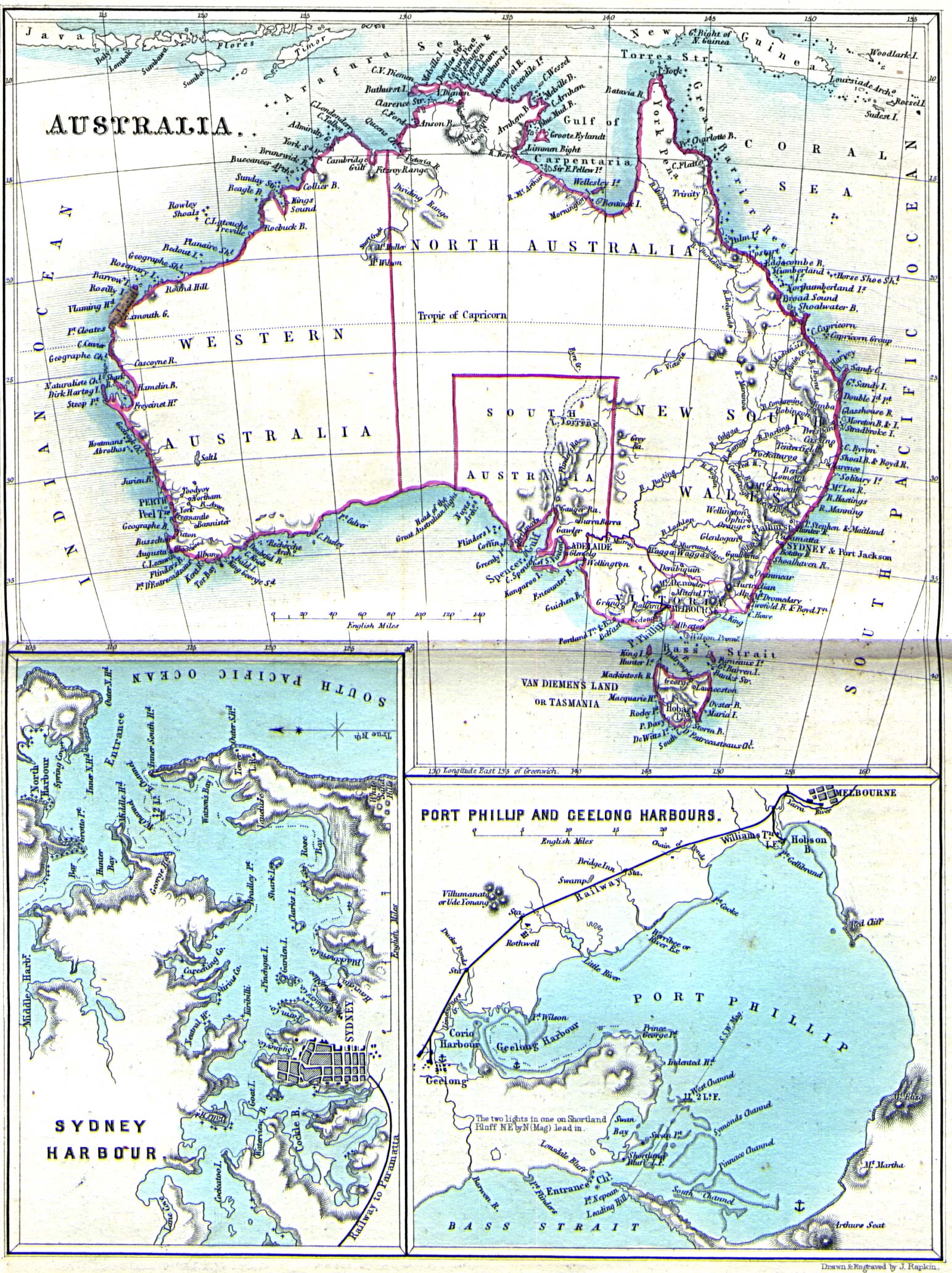
| * L'Australie en 1860 Carte d'australie avec cartons sur "Sydney Harbour" et "Port Phillip and Geelong Harbours" (Melbourne) carte extraite de : My First Voyage: A Book for Youth de William STONES. London, Simpkin Marshall & Co. Second Edition 1860. |
 |
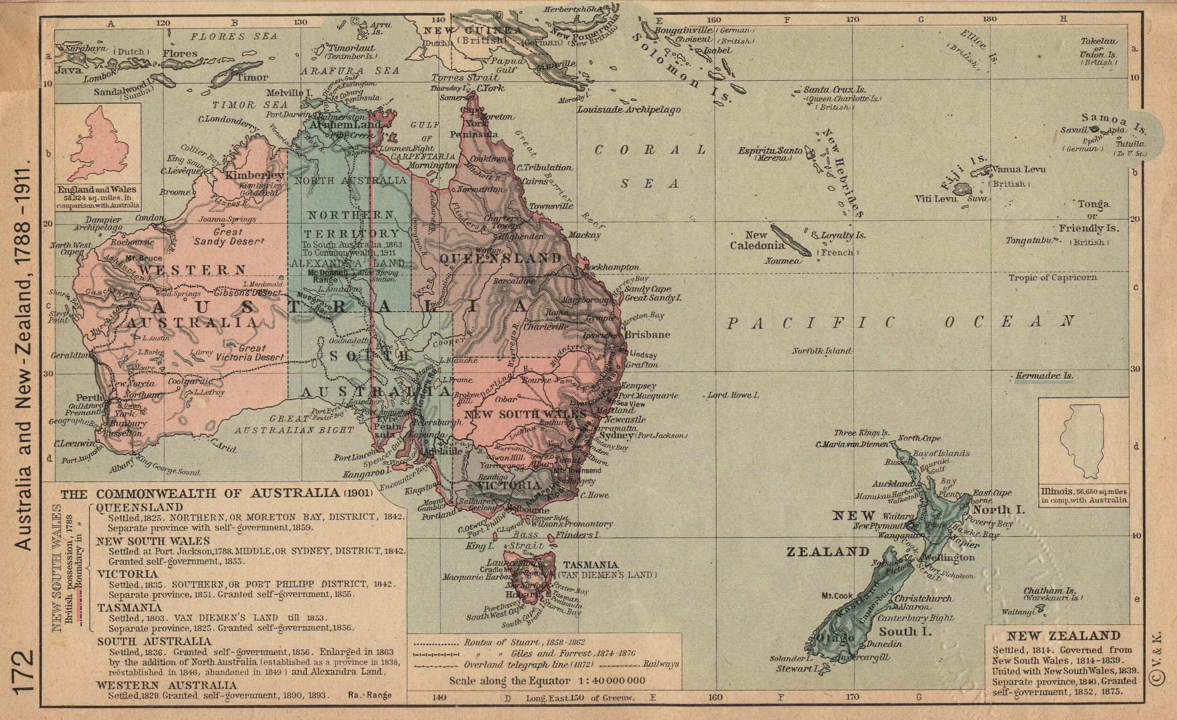 |
* L'Australie et la Nouvelle-Zélande,
1788-1911 carte extraite de : The Historical Atlas by William R. Shepherd, 1923, p 172. |
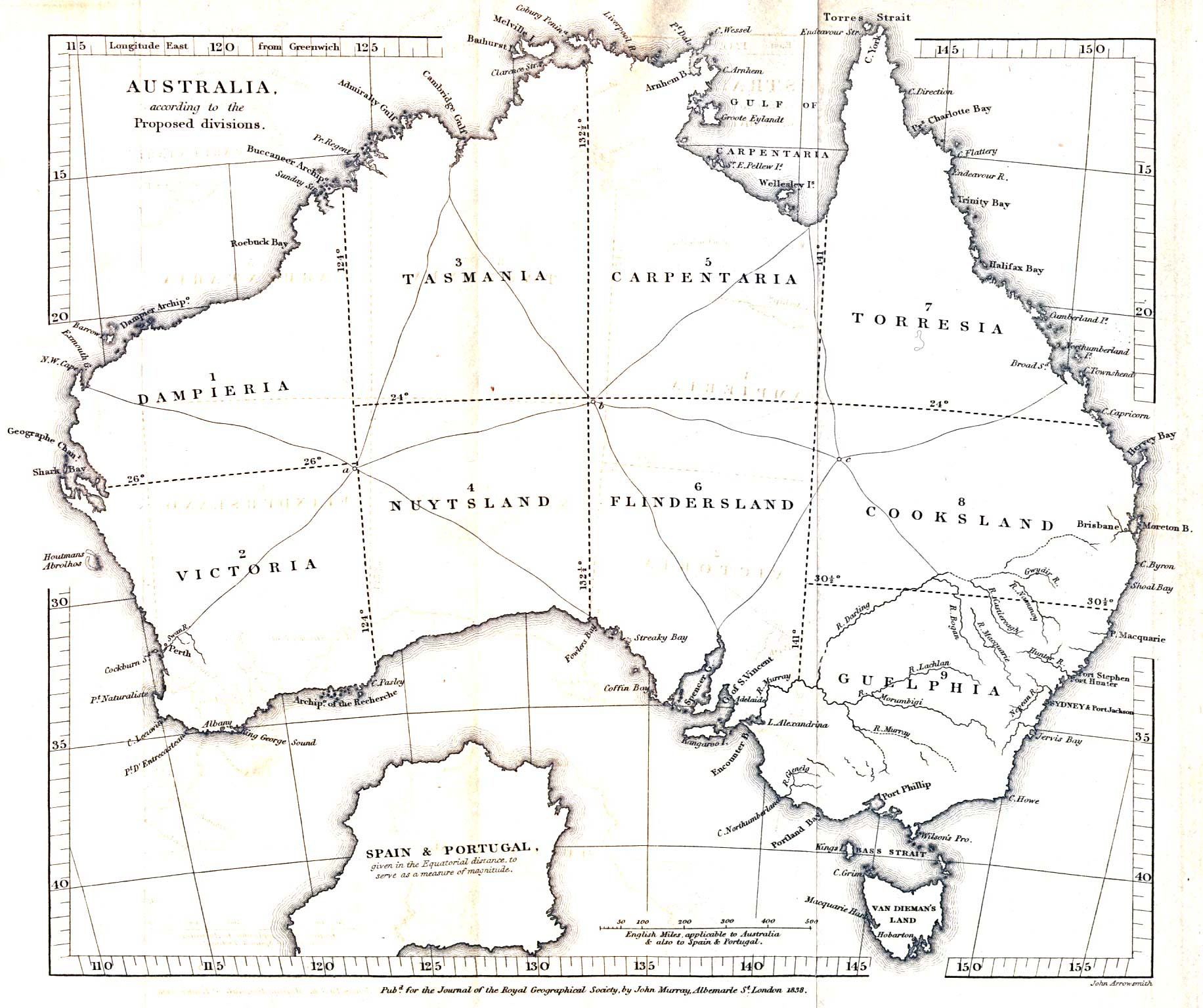
| * Australie, Délimitations
administratives proposées en 1838 Carte de proposition de délimitations administratives "Australia, according to the Proposed divisions." carte extraite de : The Journal of the Royal Geographical Society, Volume 8, 1838 accompagnant un article sur "Considerations on the Political Geography and Geographical Nomenclature of Australia" par le Captain Vetch, Royal Engineers, F.R.S. |
 |
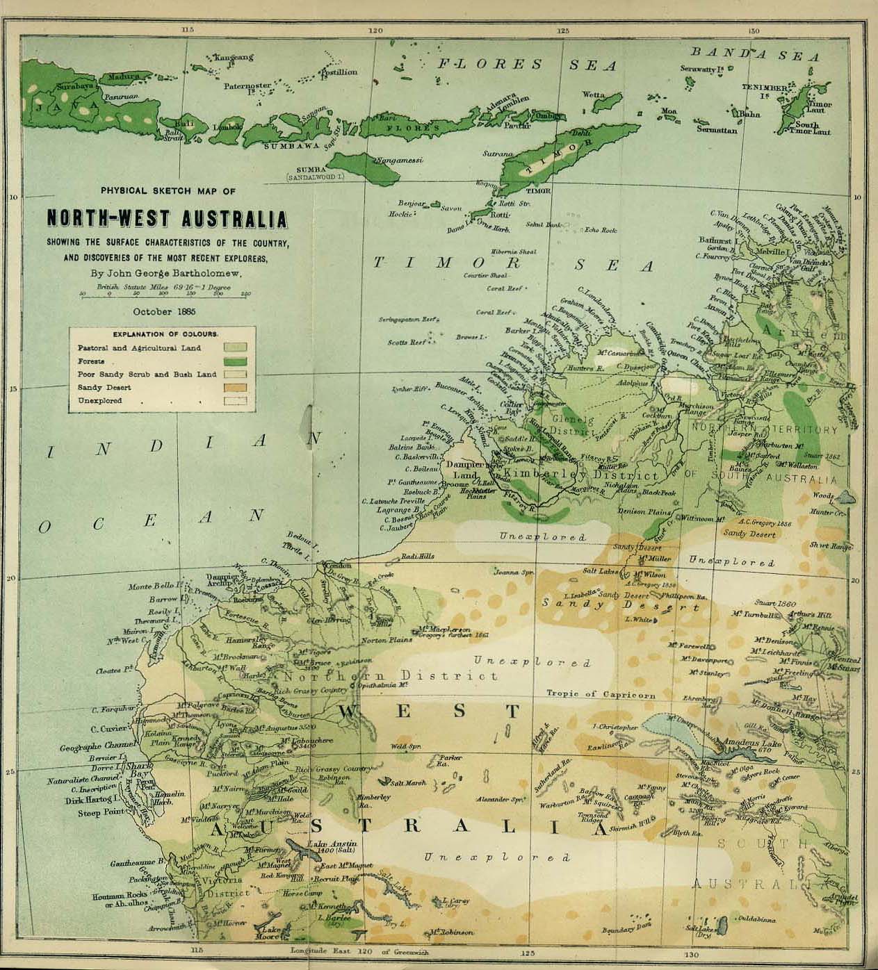 |
* Nord-ouest de l'Australie
1885 "Physical Sketch Map of Northwest Australia showing the surface characteristics of the country and discoveries of the most recent explorers." carte extraite de : The Scottish Geographical Magazine. Published by the Scottish Geographical Society and edited by Hugh A. Webster and Arthur Silva White. Volume I, 1885. |
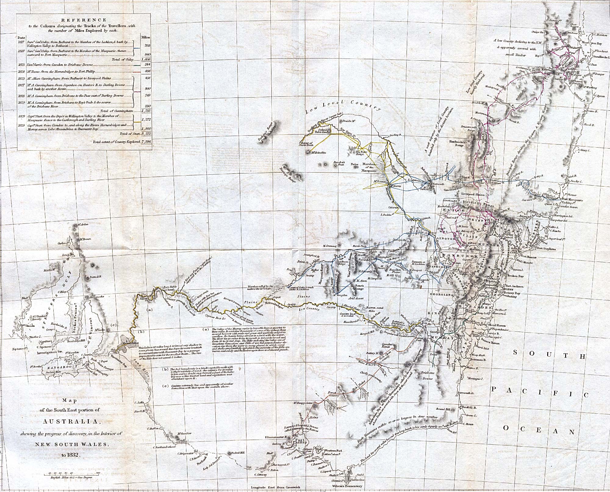
| * Sud-est de l'Australie 1832 "Map of the SouthEast portion of Australia, showing the progress of discovery, in the interior of New South Wales, to 1832." carte extraite de The Journal of the Royal Geographical Society, Volume 2, 1832 to accompany "Recent Information from Australia. From communications made to the Royal Geographical Society." |
 |
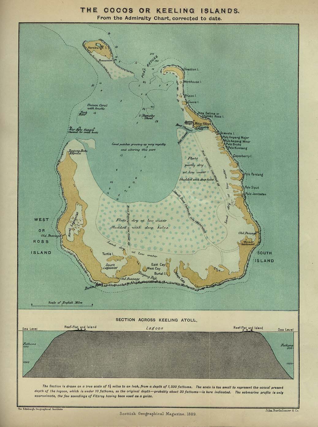 |
* Iles Cocos ou Keeling 1889
|
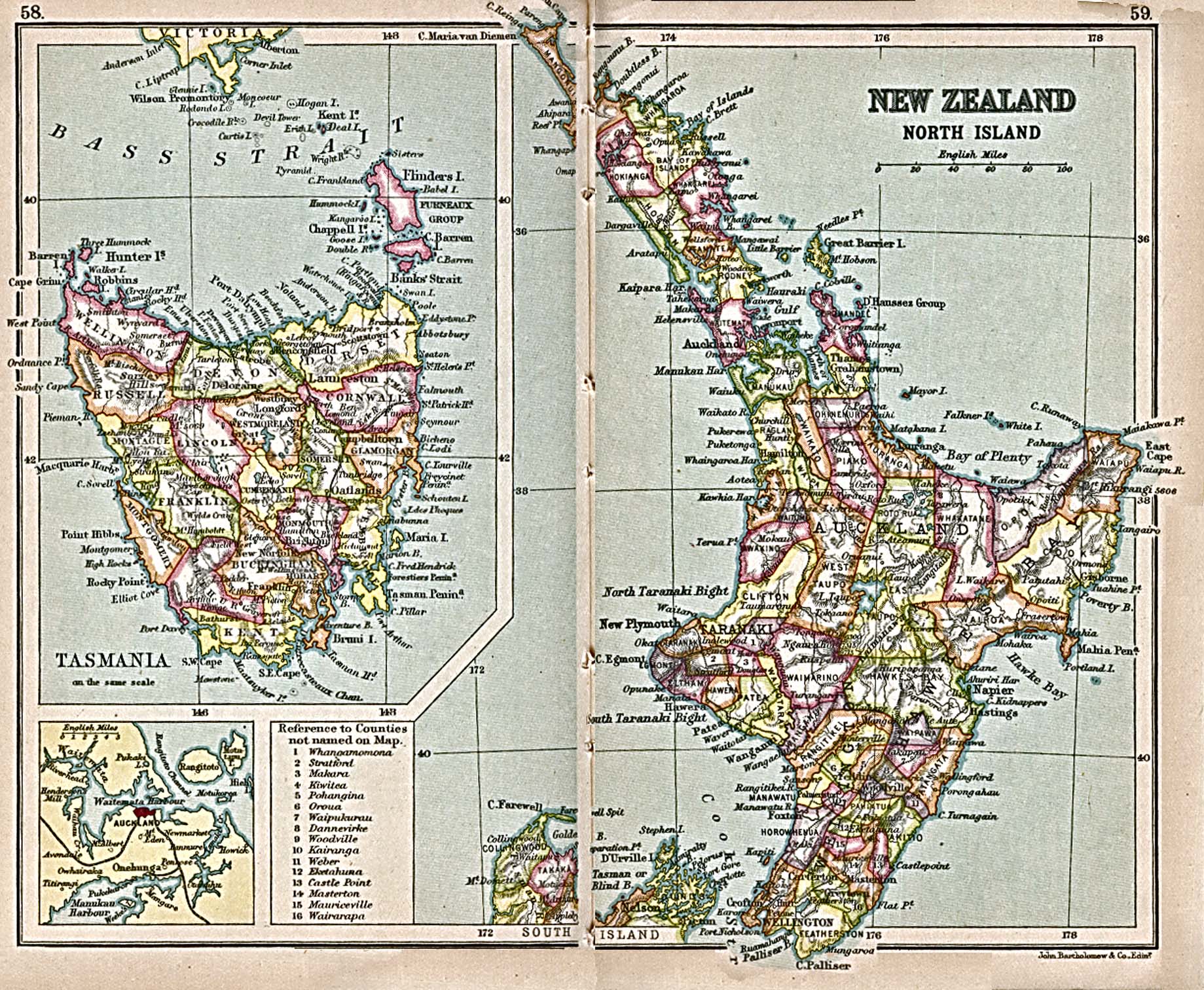
| * La Tasmanie 1913 "New Zealand, North Island" and "Tasmania" from A Literary and Historical Atlas of Africa and Australasia, by J.G. Bartholomew. 1913. |
 |
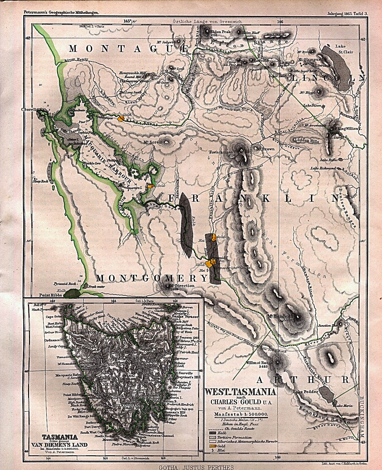 |
* L'Ouest de la Tasmanie 1865 "West Tasmania" from Mittheilungen aus Justus Perthes' Geographischer Anstalt uber Wichtige Neue Erforschungen auf dem Gesammtgebiete der Geographie von Dr. A. Volume 11, tafel 3, 1865 |
 |
 |
 |
 |
 |